Erik Neumann · 20 September 2026
Drone Mapping Exposes Unexpected Shifts in Tidal Inlet Sediment Transport
Researchers have applied drone-based LiDAR and photogrammetry systems to monitor tidal inlets along several coastlines, and the resulting datasets have revealed sediment transport patterns that differ from longstanding models in both direction and volume. These aerial surveys combine repeated flights with ground control points to generate centimeter-scale digital elevation models, which allow direct comparison of inlet morphology across seasonal cycles and storm events.
Survey Methods and Data Collection
Teams equipped multirotor drones with dual-frequency GNSS receivers and multispectral cameras to fly systematic grids over active inlets during spring and neap tide windows, while fixed-wing platforms handled larger coverage areas when wind conditions permitted. Data processing pipelines merged overlapping imagery into orthomosaics and point clouds, then subtracted sequential DEMs to calculate net sediment volume changes within inlet channels and ebb shoals. According to records from the National Oceanic and Atmospheric Administration, such volumetric shifts reached 180,000 cubic meters in a single inlet system between consecutive quarterly surveys conducted through 2025.
Observed Sediment Dynamics
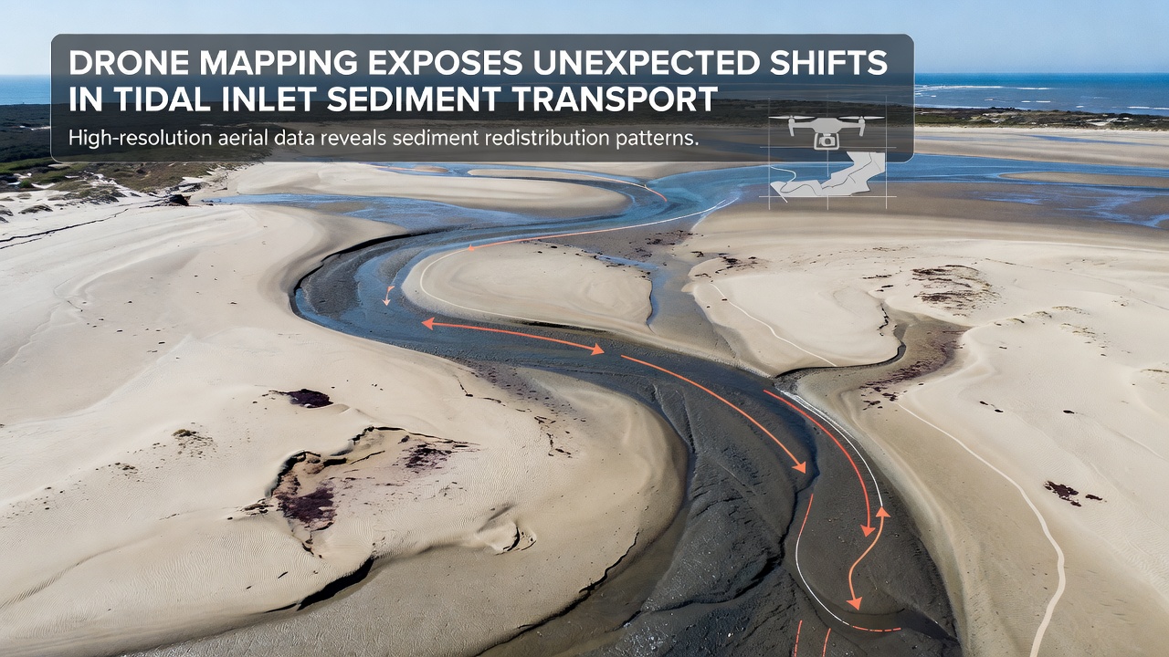
Analysis of the elevation differencing maps showed that ebb-dominated channels transported sand in directions offset by up to 35 degrees from predictions generated by earlier numerical models calibrated with sparse boat-based soundings. Flood-tide sediment plumes extended farther into back-barrier lagoons than expected, depositing material along previously stable marsh edges. These patterns emerged consistently across multiple inlets, suggesting that local bathymetric feedback and wave-current interactions had been underrepresented in prior simulations.
One study released in September 2026 documented a reversal in net longshore transport direction at an inlet on the Atlantic coast during a period of persistent northeast swells, an outcome that contradicted the established regional sediment budget. The same dataset indicated accelerated scour at the inlet throat during successive spring tides, with erosion rates climbing above 2.5 meters per month in localized zones while adjacent shoals accreted at comparable volumes.
Regional Comparisons and Case Examples
Surveys conducted in the Gulf of Mexico and along the Pacific Northwest coast produced parallel findings, although the magnitude of deviation varied with tidal range and wave climate. In the Gulf sites, drone-derived sediment budgets aligned more closely with established models during calm periods yet diverged sharply after tropical storm passages when inlet breaching and channel migration occurred rapidly. Pacific inlets exhibited stronger cross-shore exchanges driven by seasonal wave direction shifts, with material moving offshore during winter storms and returning during summer swell windows at rates exceeding those incorporated in standard transport equations.
Researchers cross-referenced the drone outputs with acoustic Doppler current profiler measurements and sediment tracer experiments, confirming that the observed morphological changes matched measured flow velocities and grain-size distributions. Data from the European Environment Agency further supported these results by showing comparable inlet adjustments at monitored sites in the North Sea, where increased storm frequency since 2023 has amplified sediment bypassing around jetties and training walls.
Integration with Existing Monitoring Programs
Coastal management agencies have begun incorporating drone survey protocols into routine inlet monitoring schedules, replacing or supplementing traditional boat-based hydrographic surveys that previously occurred at annual or biennial intervals. The higher temporal resolution supplied by monthly or post-storm flights enables earlier detection of channel migration that threatens navigation or adjacent infrastructure. Several programs now feed drone-derived elevation surfaces directly into updated hydrodynamic models, improving forecast accuracy for sediment bypassing rates and shoal evolution.
Academic groups have published validation studies comparing drone results against simultaneous satellite-derived bathymetry products and airborne lidar collections, demonstrating that the lower-altitude drone data reduce vertical uncertainty in shallow inlet environments where satellite penetration is limited. These comparisons appear in peer-reviewed outlets and support expanded use of drone platforms for targeted, high-frequency observations.
Conclusion
Drone mapping campaigns have supplied quantitative evidence of sediment transport behaviors at tidal inlets that depart from earlier model assumptions in both magnitude and direction. The datasets now guide refinements to numerical simulations and inform scheduling of dredging and beach nourishment operations. Continued integration of these high-resolution surveys with in-situ instrumentation and regional agency programs continues to refine understanding of inlet sediment budgets across varied coastal settings.