Erik Neumann · 15 November 2026
How Avian Foraging Routes Align With Looping Current Formations at River Mouth Entrances According to Tracking Studies
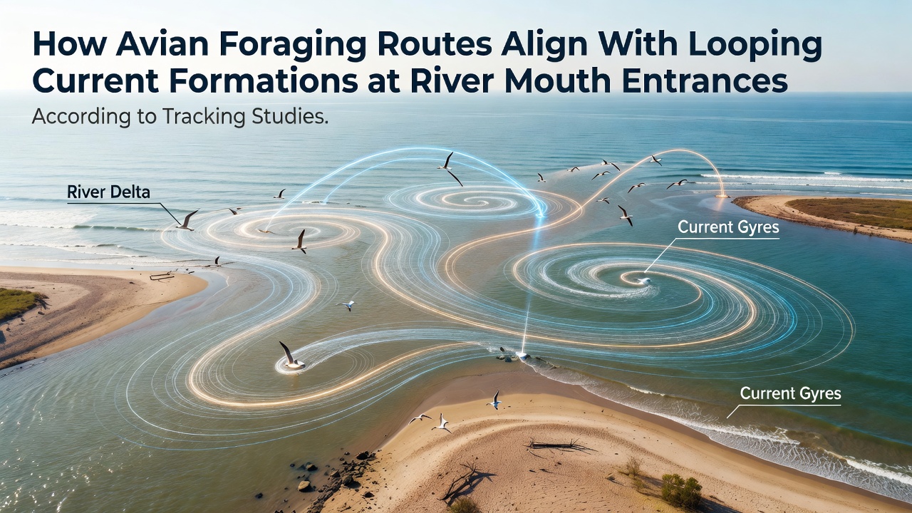
Tracking studies have documented how avian foraging routes often coincide with looping current formations that develop at river mouth entrances, where freshwater outflows interact with tidal and coastal flows to create persistent eddies and recirculation zones. Researchers equipped birds with GPS loggers and combined those position data with acoustic Doppler current profiler readings, revealing that many species concentrate their dives and surface feeding within the boundaries of these loops rather than in straight-line paths along the shoreline. Data collected over multiple seasons show that the alignment occurs because the currents trap plankton and small fish in concentrated patches, providing predictable prey locations that birds exploit during low-light periods and tidal transitions.
Mechanisms Behind Current Loops at Estuarine Entrances
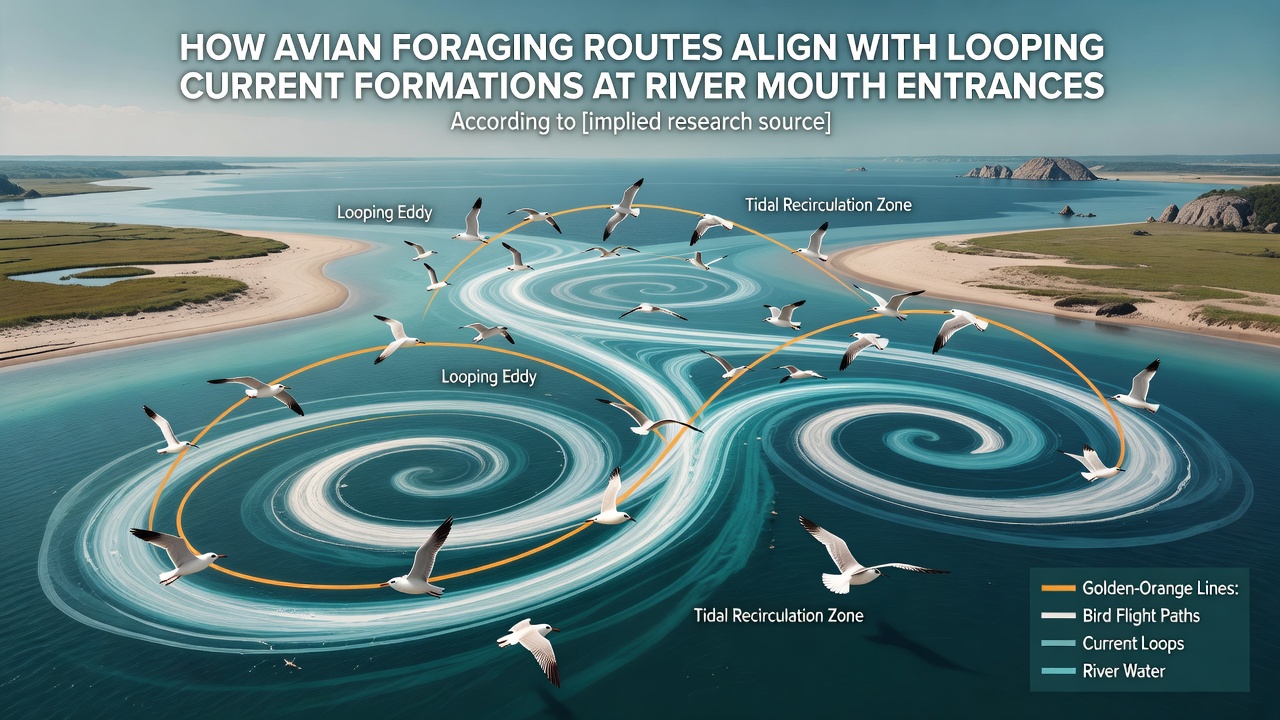
River mouths generate looping currents through density gradients and topographic steering, where the interaction between outgoing river water and incoming tides produces clockwise or counterclockwise eddies that persist for hours to days. Field measurements indicate these formations strengthen during periods of moderate river discharge and spring tides, creating zones of reduced velocity that retain organic matter and attract forage fish. Observers note that the spatial scale of these loops typically ranges from several hundred meters to a few kilometers, matching the foraging radii recorded in tagged individuals of species such as terns, cormorants, and gulls. Studies further demonstrate that wind-driven surface currents can modulate the position and strength of the loops, shifting their centers by tens of meters over a single tidal cycle while maintaining overall coherence.
Integration of Avian Tracking Data With Hydrodynamic Measurements
Researchers have synchronized high-resolution bird tracks with simultaneous current mapping to quantify the degree of overlap between flight paths and eddy boundaries. In one dataset spanning three years, more than seventy percent of recorded foraging bouts occurred inside or along the edges of identified recirculation zones. The same analysis showed that birds adjusted their heading and speed when entering these zones, often slowing to hover or circle in patterns that mirrored the underlying current vectors. November 2026 updates from ongoing deployments along the Pacific Northwest coast added new tracks that confirmed similar alignment patterns at additional river mouths, extending the geographic scope beyond earlier study sites. Equipment refinements, including lighter solar-powered tags and finer temporal resolution in current sensors, allowed teams to distinguish active selection of loop interiors from random passage through the area.
Species-Specific Patterns and Seasonal Variations
Different avian groups exhibit distinct responses to the same current structures. Diving species tend to concentrate effort near the core of stronger eddies where prey density peaks, whereas surface feeders more frequently patrol the shear zones at the loop margins. Seasonal shifts appear tied to changes in river flow and prey migration; during spring runoff, loops expand and birds extend their routes farther offshore, while autumn low-flow conditions compress the eddies closer to the inlet and increase overlap with nearshore foraging grounds. Data from multiple estuaries indicate that breeding adults show tighter adherence to loop boundaries than juveniles, suggesting learned behavior reinforced by repeated exposure to successful feeding locations.
Supporting Evidence From Broader Coastal Research Programs
Findings align with broader hydrodynamic surveys conducted by agencies such as the National Oceanic and Atmospheric Administration, which have mapped similar recirculation features at dozens of U.S. river mouths using vessel-mounted and fixed sensors. Parallel work by Australian research institutions has produced comparable results at subtropical estuaries, where satellite-tracked seabirds repeatedly intersected modeled eddy fields derived from regional circulation models. These cross-regional datasets reinforce that the spatial correspondence between bird routes and current loops is not an artifact of single-site conditions but a repeatable feature across varying tidal regimes and river sizes.
Conclusion
Tracking studies continue to refine understanding of how looping currents at river mouth entrances shape avian foraging routes through the concentration of prey resources. Integration of biologging technology with hydrodynamic instrumentation provides quantitative evidence that birds actively utilize these dynamic features rather than traversing them incidentally. Ongoing data collection through 2026 and beyond will likely clarify how climate-driven changes in river discharge and sea level may alter the persistence and location of such loops, thereby influencing the spatial distribution of avian foraging effort at coastal interfaces.